|
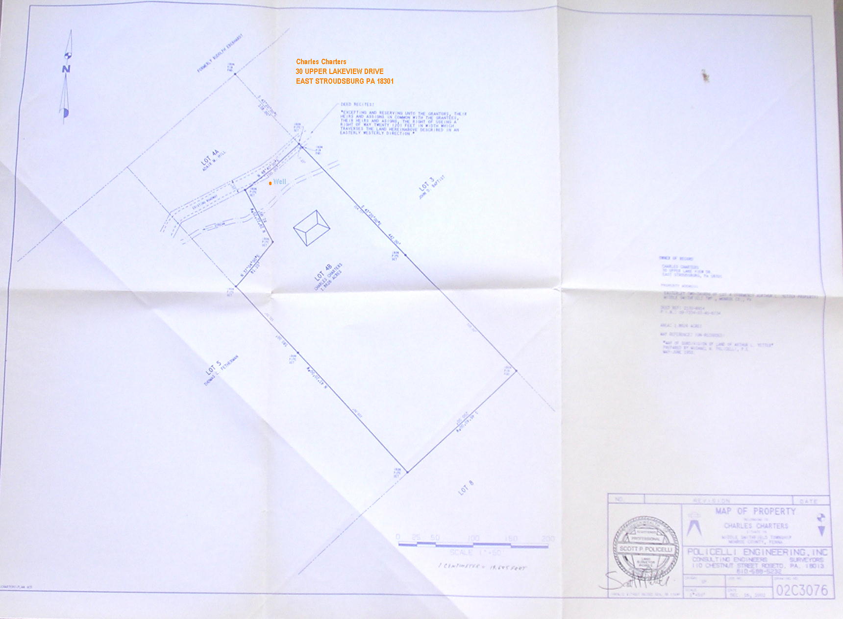
I was at my brother's house in PA and he has a water problem. He has a well on his site and it has
a bad odor. It's been tested and it's drinkable but the problem is Hydrogen Sulfide. He has to let it sit to dissipate the
odor. Has anyone had any dealings with this or any information? Here's a map of his property. Constance
Click here: Survey for Constance's Brother's Well
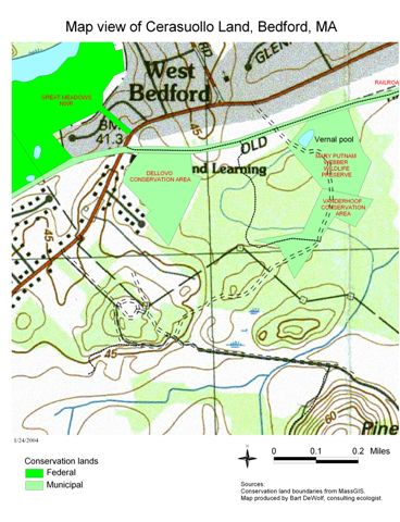
I am working with a group of people in Bedford to save 50 acres of land from a large apt.
development. The land is ecologically sensitive, surrounded and impregnated by wetlands, and an important wildlife corridor
in the region. We are exploring every angle to save this land...
One possibility is that there may be Native American burial
grounds on the land. There are several documented on the abutting Massport land.
Other important archaeological sites may
exist here. This land is privately owned, so we need to go through the proper channels, although we have a Native American
woman helping us...
Another is the possibility of buried toxic waste in one area.
If anyone is skilled in map dowsing
and interested in experimenting with a map, let me know and I will forward one to you.
Thank you,
--- Christine Wojnar
---
chriswojnar@earthlink.net
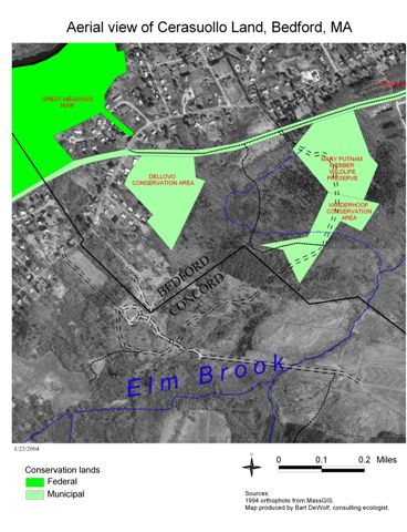
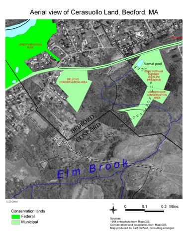
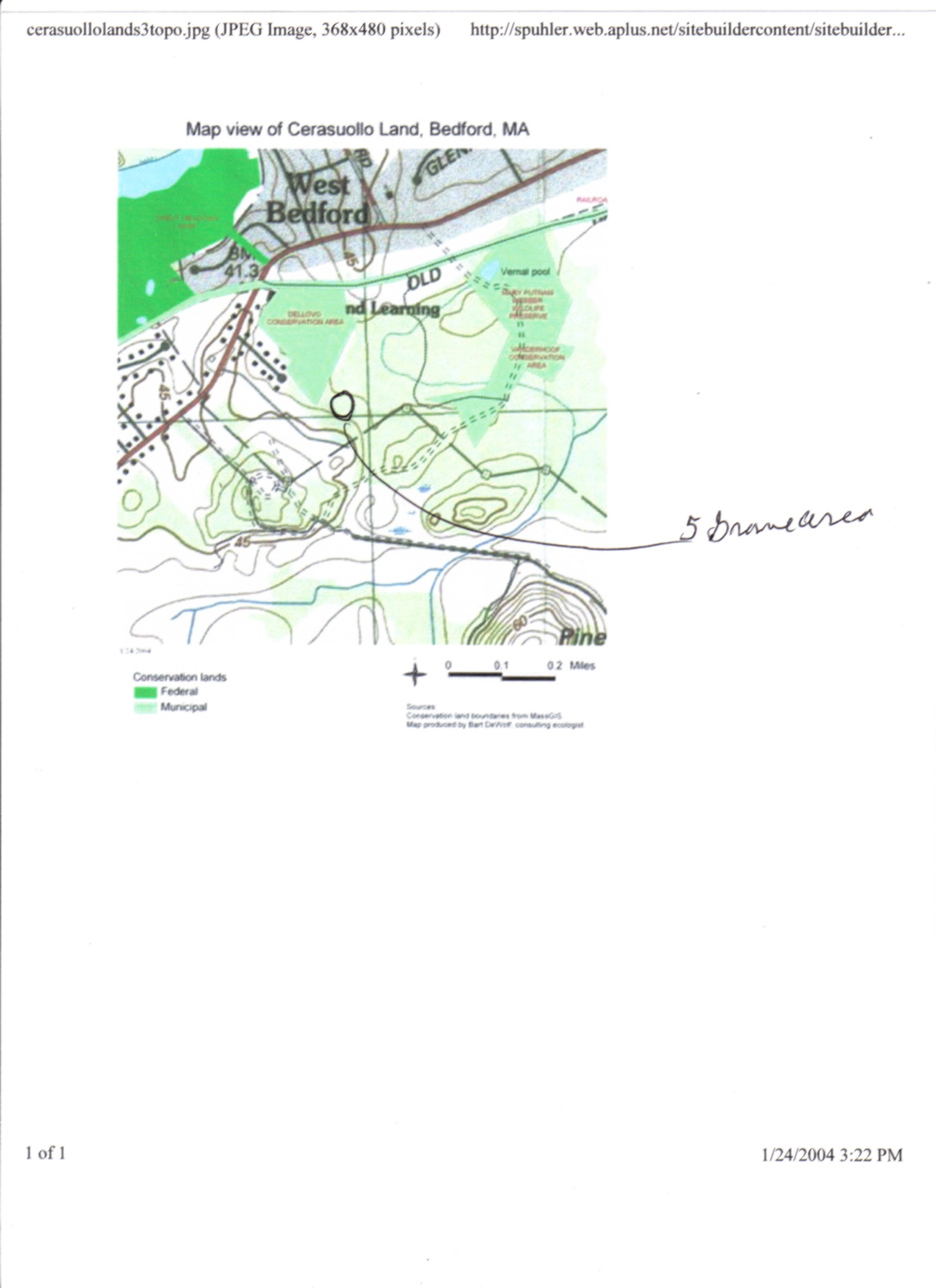
Click here for Bedford Cerasuollo land map
Map with Vernal Pool Overlay
Grave sites (from Joe Smith, Johnson, Nebraska)
The land in question is between the two light green overlays (which are conservation parcels). The
lower part of the map is Massport land close to the runways.
Topographical map of area
|
